Spotted Lake

Spotted Lake

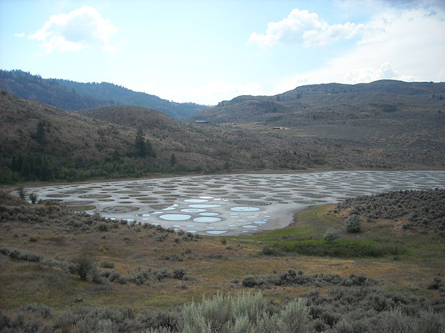
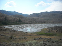
Spotted Lake is coloured in polka-dots.

  • Spotted Lake is a drainage basin with no outflow, located in British Columbia’s Similkameen Valley, in Canada.
  • The water of Spotted Lake is high in sodium and magnesium sulphate, and calcium, as well as a number of other minerals.
  • During summer, the evaporation of water in Spotted Lake leaves numerous water pools that contain significant quantities of mineral deposits, and as such, the lake looks spotty.
  • ‘Spotted Lake’ is also known in the indigenous language of the area as ‘ktlil’xWW‘ (Ha? Ki lil xw), or ‘sacred medicine lake’, and it is also known as ‘Chliluk’, ‘Khiluk’ and ‘Kliluk’.
  • Spotted Lake has been considered a sacred area by native communities, especially the local Okanagan people, with the ability to heal illness and damage to human skin.
Spotted Lake, British Columbia, Dot, Trivia, Random Facts, Canada, Water, Minerals
Spotted Lake
Image courtesy of Wikimedia Commons
  • Minerals of Spotted Lake were extracted during World War I, for the manufacture of explosives.
  • Spotted Lake can reach 700 metres (765 yards) at its longest point and 250 metres (273 yards) at its widest.
  • Spotted Lake is designated as a protected area and has been owned by the Canadian government and indigenous communities since 2001, though it was privately owned prior to this.
  • There are said to be 365 individual pools of water in summer at Spotted Lake, that range in colour from yellow, orange, green, purple and blue, depending on the mineral content.
  • The pathways between the pools of water of Spotted Lake occur due to the hardening of minerals, however walking in the lake area is prohibited.
Bibliography:
10 Things to Know About Khiluk – The Spotted Lake of British Columbia, 2014, CryptoVille, http://visitcryptoville.com/2014/01/30/10-things-to-know-about-khiluk-the-spotted-lake-of-british-columbia/
Discover the mystic ‘Spotted Lake’: A sacred site producing therapeutic waters near Osoyoos BC Canada, 2013, Strange Sounds, http://strangesounds.org/2013/04/discover-the-mystic-spotted-lake-a-sacred-site-producing-therapeutic-waters-near-osoyoos-bc-canada.html
Spotted Lake (Khiluk), British Columbia, Canada, 2014, Globetrotter’s Wanderlust, http://globetrotterswanderlust.blogspot.com.au/2014/09/spotted-lake-khiluk-british-columbia.html
Spotted Lake, 2015, Wikipedia, https://en.wikipedia.org/wiki/Spotted_Lake
Spotted Lake, n.d, British Columbia, http://apps.gov.bc.ca/pub/bcgnws/names/16532.html


Amazon:       

Hvítserkur

Hvítserkur

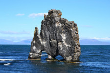
Let your imagination run wild interpreting the form of Hvítserkur.

  • Hvítserkur is an eroded rock that protrudes out from the shores of north-western Iceland, in the waters of Húnafjörður, near the Vatnsnes peninsula.
  • Hvítserkur reaches a height of 15 metres (49 feet) from sea level, and it is a grey and white colour, with the white caused by minerals deposited through bird droppings.
  • Hvítserkur is made primarily of basalt rock, that has been eroded over years due to the constant activity of ocean waves.
  • In 1955, there were three holes at the base of Hvítserkur, giving it four ‘legs’, however, there were concerns that the structure would give way, so plans were made that year to preserve the structure with concrete.
  • Birds, including seagulls and fulmars, are attracted to nest on Hvítserkur, while seals are located nearby.
Hvítserkur, Rock, Sea, Ocean, Iceland, Blue, Grey, Trivia, Ten Random Facts
Hvítserkur
Image courtesy of Janko Hoener/Flickr
  • The term ‘Hvítserkur’ in Icelandic, means ‘white shirt’, which refers to the mottled white colours visible on the formation.
  • Before the crater wore away, Hvítserkur is said to have plugged the mouth of a now extinct volcano.
  • The base of Hvítserkur is reinforced with concrete, which stabilises the formation to prevent it from breaking away, and this has reduced the number of large holes at the base of the structure from three, to two.
  • Hvítserkur can be seen from a viewing platform on land, and the formation is close enough to the shore, that it can be reached on foot at low tide.
  • Local legend suggests that Hvítserkur was once a troll, who failed to evade the morning sun, and as a result, was petrified in stone.
Bibliography:
Ætla að styrkja Hvítserk í Húnaflóa, 1955, VÍSIR, http://timarit.is/view_page_init.jsp?issId=82970&pageId=1182163&lang=is&q=styrkja
Hvítserkur, 2015, Atlas Obscura, http://www.atlasobscura.com/places/hvitserkur
Hvítserkur, 2015, Wikipedia, https://en.wikipedia.org/wiki/Hv%C3%ADtserkur
Ragnarsdóttir R, Hvítserkur | The Troll of North-West Iceland, n.d, Guide to Iceland, https://guidetoiceland.is/connect-with-locals/regina/hvitserkur-up-north

Amazon:       

Marble Caves

Marble Caves

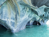
Light cannot escape in the labyrinth of the Marble Caves.

  • The Marble Caves is a group of caves made of marble, situated in the Chile portion of the General Carrera Lake, in South America.
  • ‘Marble Caves’ is also known as ‘Marble Caverns’, as well as ‘Marble Cathedral’ and ‘Marble Chapel’, although these terms may refer to particular formations in the area.
  • Only boats of small size can be used to view and make their way through the Marble Caves, which are located in perfectly clear, stunning turquoise water.
  • The marble stone of the Marble Caves is rich in calcium carbonate, making up approximately 94% of the formation.
  • It is estimated that the total weight of the Marble Caves combined, would be 5 billion tonnes (5.5 billion tons).
Marble Cave, Trivia, Random Facts, Ten, Blue, Water, Chile, Lake,
Part of Marble Caves
Image courtesy of Dan Lunberg/Flickr
  • The marble colour of the Marble Caves ranges from white to grey to blue, and also includes the odd pink tint.
  • The Marble Caves were formed by water and weather erosion over a span of thousands of years.
  • ‘Marble Caves’ are known in Spanish as the ‘Catedral de Mármol’ or the ‘Capilla de Mármol’.
  • There are three formations in the Marble Caves group – the cathedral, the chapel and the cave.
  • To access the Marble Caves, a boat is usually used from the small remote town of Puerto Rio Tranquilo, while the most common period to visit is from December to February.
Bibliography:
General Carrera Lake Is Chile’s Answer To Everything Blue And Beautiful, 2014, Huff Post Travel Canada, http://www.huffingtonpost.ca/2014/01/22/general-carrera-lake-photos_n_4640023.html
The Marble Cathedral of Chile: Are These the World’s Most Beautiful Caves?, 2011, Daily Mail Australia, http://www.dailymail.co.uk/sciencetech/article-2021090/The-marble-cathedral-Chile-Natural-wonder-worlds-beautiful-cave-network.html
The Marble Cathedral of General Carrera Lake, 2011, Kuriositas, http://www.kuriositas.com/2011/05/marble-cathedral-of-general-carrera.html
Marble Caves, Chile, 2015, Don’t Complain, http://www.dont-complain.com/2015/01/17/marble-caves-chile/

Amazon:       

Bora Bora

Bora Bora

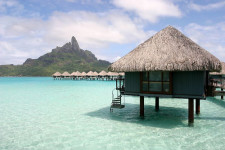
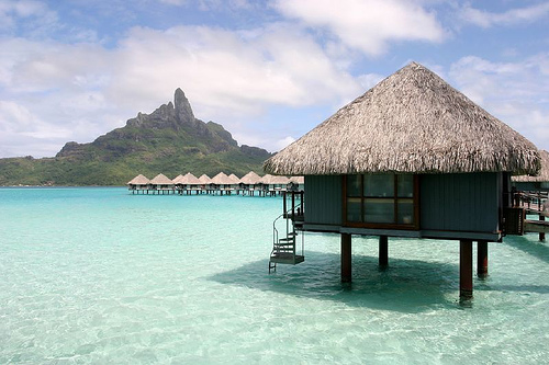
Bora Bora is surrounded by beautiful blue.

  • Bora Bora is an island located in French Polynesia in the Pacific Ocean, and it is one of the Leeward Islands situated on the western side of the Society Islands archipelago.
  • Bora Bora is surrounded by a reef and islets, creating a notable lagoon, and the main island features two mountain peaks created by a volcano that is now extinct.
  • The area of Bora Bora covers 29.3 square kilometres (11.3 square miles), and the peak of Mount Otemanu is the highest point at 727 metres (2385 feet).
  • In 1722, Jakob Roggeveen, a Dutch explorer, was the first known European to see the island of Bora Bora, while British explorer, Captain James Cook, landed on the island in 1770.
  • Bora Bora was used as a base for the United State’s Pacific operations for at least four years during World War II, housing thousands of military personnel, and it was significantly fortified but no attack was encountered.
Bora Bora, Trivia, Ten Random Facts, Island, Pacific, Hut, Water, Scene, Beauty, Site, Holiday,
Part of Bora Bora
Image courtesy of Benoit Mahe/Flickr
  • Bora Bora thrives as a tourist destination due to its picturesque landscape; abundant resorts, most of which have bungalows projecting out into the lagoon water; and many water sport attractions, including scuba diving.
  • From 2007 to 2008, the total local population of Bora Bora was nearly nine thousand people.
  • Bora Bora is commonly considered the most beautiful island of the Pacific or even in the world, due to its scenic views, white beaches, abundant marine flora and fauna including manta rays, and turquoise coloured water.
  • ‘Bora Bora’ was originally known as ‘Pora Pora’ in the native Tahitian language, meaning ‘first born’.
  • An airport was constructed on one of the Bora Bora islets during World War II, and it has since been used by visitors to the island, while boats are commonly used for transportation purposes in the area.
Bibliography:
Bora Bora, 2015, The Islands of Tahiti, http://www.tahiti-tourisme.com/islands/borabora/bora-bora.asp
Bora Bora, 2015, Tahiti, http://www.tahiti.com/island/bora-bora
Bora Bora, 2015, Wikipedia, https://en.wikipedia.org/wiki/Bora_Bora
Introducing Bora Bora, 2015, Lonely Planet, http://www.lonelyplanet.com/tahiti-and-french-polynesia/bora-bora

Amazon:       

Phi Phi Islands

Phi Phi Islands

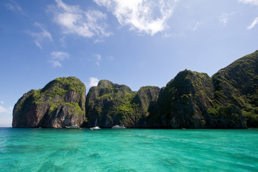
The Phi Phi Islands are some of the most beautiful on earth.

  • The Phi Phi Islands is a small group of islands located in Thailand, almost midway between the tip of Phuket and the mainland, in the Malacca Strait.
  • The largest island of the Phi Phi Islands is Ko Phi Phi Don, which covers 9.7 square kilometres (3.7 square miles) of a total surface area of 12.25 square kilometres (4.7 square miles).
  • There are six primary islands in the Phi Phi Islands collective group, although a couple are simply large limestone formations, while the other main island is Ko Phi Phi Ley (or Lee or Leh).
  • Phi Phi Islands has become a very popular tourist destination, attractive for its activities like diving, snorkelling and kayaking to explore the notable and colourful aquatic fauna and flora.
  • The Phi Phi Islands were tragically hit by a tsunami in 2004, a day after Christmas, destroying around 70% of the area’s infrastructure and much of the islands’ population.
Phi Phi Islands, Bay, Water, Thailand, Trivia, Ten Random Facts, Water, Rock, Place, NaturePart of the Phi Phi Islands
Image courtesy of Every Stock Photo
  • Notably, Phi Phi Islands was the filming site of The Beach (2000), which is said to have resulted in a massive tourism boom.
  • In 2013, the local population of Phi Phi Islands consisted of 2000 to 3000 individuals, and walking and cycling are the main forms of transport, as the number of four wheeled motor vehicles on the islands is very limited.
  • ‘Phi Phi Islands’ were originally known as ‘Palau Api-Api’, translatable as ‘Fiery Island’ after certain trees that are said to grow on the islands.
  • Ferries or speedboats are typically used to reach Phi Phi Islands from the mainland, taking about 45 to 90 minutes in travel time.
  • Tourists in the thousands visit Phi Phi Islands daily, although such tourism has caused notable disturbance in the surrounding ecosystem, while lobbying for visitor numbers to be capped to reduce the threat, has been carried out.
Bibliography:
About Phi Phi Island, 2011, Zeavola, http://www.zeavola.com/aboutPhiPhiIsland-en.html
Phi Phi Islands, 2007, Gokoh Phi Phi, http://www.gokohphiphi.com/
Phi Phi Islands, 2015, Hotels.com, http://www.phiphi.phuket.com/#
Phi Phi Islands, 2015, Wikipedia, https://en.wikipedia.org/wiki/Phi_Phi_Islands

Amazon:       

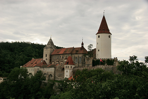
Křivoklát Castle

Křivoklát Castle

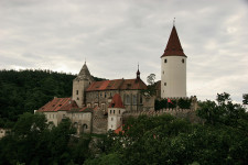
You don’t ever want to get trapped in Křivoklát Castle.

  • Křivoklát Castle is a castle of Gothic style, found in the western Czech Republic in Central Europe, and it was originally a royal residence.
  • Currently Křivoklát Castle has been adapted as a museum featuring sculpture, weaponry, hunting trophies, and paintings.
  • Křivoklát Castle is said to have existed in 1110 AD, most likely on a different site, while construction on the current site began in the 1200s under orders of the kings of Bohemia.
  • Křivoklát Castle is situated in an elevated position, in a highly lush environment set among forests, and there are plenty of walking tracks available to explore the area.
  • Among other things, Křivoklát Castle features a chapel, an extensive library with 52,000 books, a large cylindrical tower, and a grand hall.
 Křivoklát Castle, Krivoklat, Trivia, Ten Random Facts, Castle, Building, Construction, Czech Republic, Europe
Křivoklát Castle
Image courtesy of Elena Pleskevich/Flickr
  • At an annual tourist rate of 250,000 people, Křivoklát Castle is ranked second among the most popular castles in its homeland.
  • Křivoklát Castle has undergone many additions and repairs over the centuries, and some parts were rebuilt due to damage from fires, and attacks.
  • Křivoklát Castle was notorious for its status as an unforgiving prison from the 1500s to 1600s, and as such, tools used for torture purposes are on display in the castle.
  • In 1826, a fire raged through Křivoklát Castle, although the castle was renovated and repaired in the 1800s and 1900s; and the castle was bought by the Czech government in 1929.
  • An entrance fee is payable at Křivoklát Castle and a variety of guided tours are available, as well as exhibitions and festivals at various times in the year.
Bibliography:
Hrad Křivoklát, 2015, Hrad Křivoklát, http://www.krivoklat.cz/
Křivoklát Castle, 2011, Prague Guide, http://www.prague.fm/6826/krivoklat-castle/
Křivoklát Castle, 2015, Czech Tourism, http://www.czechtourism.com/c/krivoklat-castle/
Křivoklát Castle, 2015, Wikipedia, https://en.wikipedia.org/wiki/K%C5%99ivokl%C3%A1t_Castle
Prague to Krivoklat – Krivoklat Castle Tours, 2015, Private Prague Guide, https://www.private-prague-guide.com/krivoklat-prague/

Amazon:        

Related Posts Plugin for WordPress, Blogger...