Son Doong Cave

Son Doong Cave

How could a rock hold such a large cave as the Son Doong Cave?

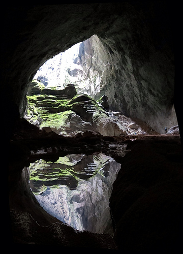
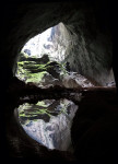
  • Son Doong Cave is a rock cave found in Central Vietnam, in Southeast Asia, close to the border of Laos.
  • ‘Son Doong Cave’ is also known as ‘Hang Son Doong’, which is Vietnamese for ‘mountain river cave’.
  • The Son Doong Cave entrance was discovered in the early 1990s by a local Vietnamese named Ho Khanh, however the cave remained untouched and hidden for many more years, due to its relatively inaccessible location.
  • Son Doong Cave is the home of the large Rao Thuong River, that flows quite quickly underground, notably making rushing and roaring sounds audible outside the cave.
  • The entrance to Son Doong Cave was rediscovered in 2008, again by Ho Khanh, and it wasn’t until 2009 that it was first explored, with Ho Khanh’s assistance and a team of cave experts and scientists, as steep inclines and intimidating sounds caused by the hidden river, would’ve deterred locals.
Son Doong Cave, Trivia, Ten Random Facts, Cave, Water, Vietnam, Entry, Exit, Light, Reflection
Son Doong Cave
Image courtesy of Doug Knuth/Flickr
  • As of 2015, Son Doong Cave was still listed as the largest known cave on Earth, at 200 metres (660 feet) in height, 5 kilometres (3.1 miles) in length and 150 metres (490 feet) in width, at the greatest points.
  • Limestone is the main stone type that makes up Son Doong Cave and it also has some large deposits of calcite.
  • Particularly large cave pearls and stalagmites can be found in Son Doong Cave, with the cave pearls reaching sizes of around 7.5 cm (3 inches) in diameter and stalagmites reaching up to 80 metres (262 feet) in height.
  • The first tourists to explore Son Doong Cave did so in late 2013, spending $3,000 USD per person, while only 500 permits to enter the cave were given out in 2015.
  • Son Doong Cave is located in a section of the Phong Nha-Kẻ Bàng National Park, which was declared a UNESCO World Heritage Site in 2003.
Bibliography:
Lee J, Dive Into ‘Infinity’ With Dizzying Views of A Colossal Cave, 2015, National Geographic, http://news.nationalgeographic.com/2015/05/150520-infinity-cave-son-doong-vietnam-virtual-tour-photography-conservation/
Son Doong Cave, 2015, Oxalis Travel, http://oxalis.com.vn/cave/son-doong-cave/
Sơn Đoòng Cave, 2015, Wikipedia, https://en.wikipedia.org/wiki/S%C6%A1n_%C4%90o%C3%B2ng_Cave

Amazon:       

Cape of Good Hope

Cape of Good Hope

You better have a lot of hope when travelling the seas of the Cape of Good Hope.

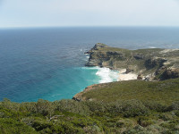
  • The Cape of Good Hope is a narrow, rocky piece of land that juts out into the South Atlantic Ocean, found in South Africa’s Cape Peninsula.
  • The Cape of Good Hope is part of the Table Mountain National Park, and contrary to popular belief, is not actually the southernmost point of Africa, as that title goes to Cape Agulhas.
  • ‘The Cape of Good Hope’ is also known simply as ‘The Cape’ and is known in Afrikaans as ‘Kaap die Goeie Hoop’.
  • The Cape of Good Hope is regarded as particularly important by many sailors, as it is used as a reference point when sailing to Australia or East Asia.
  • Bartolomeu Dias, an explorer from Portugal, was the first known person from Europe to discover the Cape of Good Hope, doing so in 1488, and named it ‘Cape of Storms’.
Cape of Good Hope, Water, Africa, Rocks, Trivia, Ten Random Facts, Place, Head
Cape of Good Hope
Image courtesy of Iryna Kuchma/Flickr
  • The Da Gama and the Dias Crosses are situated on the Cape of Good Hope as beacons, and when the two are aligned they point towards a major water vehicle hazard known as ‘Whittle Rock’.
  • Despite the bad weather that Bartolomeu Dias experienced at the Cape of Good Hope, John II of Portugal, the king who commissioned the initial expedition, renamed it as such to portray a more positive perspective on sailing to India.
  • There are around 250 bird species, including penguins, that are found in the Cape of Good Hope vicinity, while other animals from zebras, deer, reptiles, antelopes, otters and rodents are also found in the area.
  • Approximately 1100 native plant species populate the Cape of Good Hope, and includes large quantities of shrubby vegetation known as ‘fynbos’, like proteas, cone bushes and tree pincushions.
  • By legend, the Cape of Good Hope is the haunted location of the ghostly ship The Flying Dutchman, which is said to be cursed so that it can never reach land.
Bibliography:
Cape of Good Hope, 2015, Pano, http://www.airpano.com/360Degree-VirtualTour.php?3D=cape-good-hope-rsa
Cape of Good Hope, 2015, Wikipedia, https://en.wikipedia.org/wiki/Cape_of_Good_Hope

Amazon:       

Table Mountain

Table Mountain

Table Mountain is a masterpiece of the giants.

  • Table Mountain is a mountainous landform with a particularly flat top, found near South Africa’s Cape Town.
  • From sea level, Table Mountain is 1084.6 metres (3,558 feet) in height, and at the top it is 3 kilometres (2 miles) across at its widest point.
  • The first record of a person climbing Table Mountain was in 1503, and the climber was António de Saldanha, a navigator from Portugal and modern day Spain.
  • Table Mountain is notably topped with orographic clouds regularly, that create a surreal table cloth like covering over the mountain; a local legend attributes this to a smoking duel between the Devil and a pirate.
  • At least 1500 species of plant populate Table Mountain, most of which are endemic to the area and referred to as ‘fynbos’, or shrubby vegetation, some of which is endangered.
Table Mountain, Trivia, Ten Random Facts, South Africa, Capetown, Rocks, City, Nature
Table Mountain
Image courtesy of warrenski/Flickr
  • Animals found on Table Mountain include rock hyraxes, snakes, amphibians, mongooses, lizards and porcupines, as well as the mountain’s rare ‘ghost frogs’ that are critically endangered.
  • There are two main ways Table Mountain can be accessed, by hiking and by a cableway; the latter built from 1926 to 1929 after years of ideas and planning.
  • Sandstone makes up most of the rock structure of Table Mountain, and it also features unusual sandstone cave complexes.
  • Table Mountain is very popular among tourists, and as of 2015, at least 24 million people had used the cableway since it was built.
  • Table Mountain was voted as one of the New 7 Wonders of Nature in 2011, and it is part of the Table Mountain National Park.
Bibliography:
Table Mountain, 2014, SA Venues, http://www.sa-venues.com/attractionswc/table-mountain.htm
Table Mountain, 2015, Wikipedia, https://en.wikipedia.org/wiki/Table_Mountain

Amazon:       

Zhangye Danxia Landform Geological Park

Zhangye Danxia Landform Geological Park

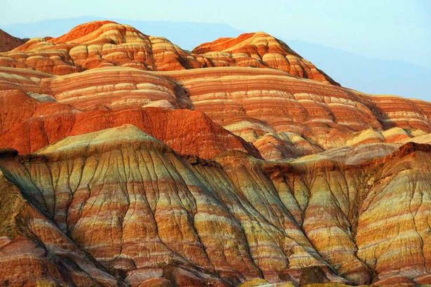
Someone has imprinted a rainbow onto Zhangye Danxia Landform Geological Park.

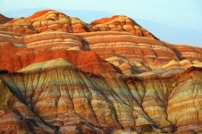
  • Zhangye Danxia Landform Geological Park is a geologically significant area consisting of large formations of distinctly rainbow coloured rock.
  • Zhangye Danxia Landform Geological Park is situated in the province of Gansu in Asia’s China, and the closest city is Zhangye.
  • ‘Zhangye Danxia Landform Geological Park’ is also known as ‘Zhangye Danxia’, ‘Zhangye Danxia Geopark’, ‘Zhangye Danxia Landform’, ‘Landform of Zhangye’, ‘Rainbow Mountains’ and ‘Zhangye Danxia Wonders’.
  • Zhangye Danxia Landform Geological Park is commonly and incorrectly confused with other Danxia formations in China, that are listed as part of the China Danxia UNESCO World Heritage Site.
  • Zhangye Danxia Landform Geological Park spreads across an area of 300 to 510 square kilometres (116 to 197 square miles), and in November 2011, it was officially granted geopark status.
Zhangye Danxia Landform Geological Park, Beauty, Rainbow, Mountain, China, Ten Random Facts, Red, Orange, Green
Zhangye Danxia Landform Geological Park
Image courtesy of The Mirror/Assumed Public Domain
  • The rocks of Zhangye Danxia Landform Geological Park are made primarily of sandstone and other layered minerals, that reach hundreds of metres in height.
  • Water, wind and other weather erosion constantly wear the rocks of Zhangye Danxia Landform Geological Park, creating numerous ‘hills’ and abstract shapes.
  • Zhangye Danxia Landform Geological Park is very popular among tourists, and it has been listed among the ‘most beautiful’ places in China and the world, numerous times.
  • The rock colours of Zhangye Danxia Landform Geological Park range from red, blue, yellow and green, and the colours are caused by metamorphic progressions.
  • An entrance fee is generally payable when visiting the Zhangye Danxia Landform Geological Park, and to see the colours of the rocks at their best, it is best to visit on sunny days in the mornings or at sunset, in all seasons except winter.
Bibliography:
Wu A, Rainbow Mountains: Zhangye Danxia Landform Geological Park, 2015, China Highlights, http://www.chinahighlights.com/zhangye/attraction/danxia-landform-geological-park.htm
Zhangye Danxia National Geological Park, 2015, Wikipedia, http://en.wikipedia.org/wiki/Zhangye_Danxia_National_Geological_Park

Amazon:       

Sand

Do you undersand the wonders of sand?

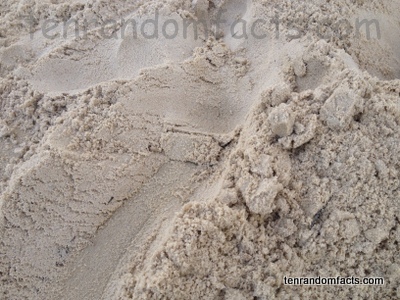
  • Sand is a group of rocks and minerals that have eroded into fine, minuscule grains; and large quantities of the substance is often found on coastlines and in desert areas.
  • Sand can be composed of a variety of items, including particles of calcium carbonate, coral, quartz and shellfish.
  • A sand grain can be defined as a particle that is between 0.06 and 2 millimetres (0.002 and 0.08 of an inch) in diameter, and is smaller than a piece of gravel but larger than a speck of silt.
  • The colour of sand varies greatly, depending on its location and the rocks and minerals that make up the particles, although it is commonly observed to be white, brown, tan, cream, red, grey or black.
  • The unique shape of a piece of sand can help determine its source and age, while more pronounced angles often indicate a more recently formed grain.

Sand, Brown, Earth, Beach, Ten Random Facts, Australia, Tan,

  • Some individuals collect samples of sand as a hobby, and these people are called ‘arenophiles’.
  • Sand is one of the primary components of soil, and the ratio of sand to clay and silt, partly determines the quality of the soil.
  • Dry sand can be dangerous if inhaled, so caution must be taken while using machines such as sandblasters.
  • Due to the weight of sand, bags of the substance can be used to keep objects stationary by weighing them down, or it can be placed inside an item to make it heavier.
  • Sand has many applications and is used for concrete and brick making; is the main ingredient in glass making; and is often used for entertainment purposes, especially by children to play in, or make sand castles or other structures, due to its ability to be shaped when damp.


Bibliography:
At the Beach, n.d, Inspiration Green, http://www.inspirationgreen.com/magnified-grains-of-sand.html
Sand, 2015, Wikipedia, http://en.wikipedia.org/wiki/Sand

Amazon:       

Shilin Stone Forest

Shilin Stone Forest

Don’t get lost in the Shilin Stone Forest labyrinth.

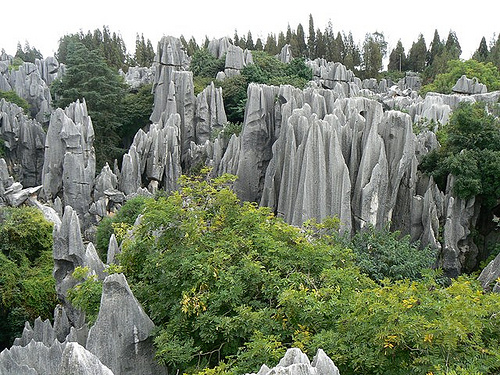
  • Shilin Stone Forest is a group of natural rock formations located in the province of Yunnan, in China, Asia.
  • ‘Shilin Stone Forest’ is also known as ‘Shilin’ which means ‘stone forest’ in Chinese, ‘Shilin Geopark’, ‘Stone Forest’, and ‘Stone Forest Geopark’.
  • The rocks of Shilin Stone Forest are made of limestone, shaped by constant erosion and weathering.
  • There are thousands of rocks in the Shilin Stone Forest, and the rocks have the appearance of petrified trees or stalagmites.
  • The South China Karst, which was declared a UNESCO World Heritage Site in 2007, includes the Shilin Stone Forest.
Shilin Stone Forest, China, Rocks, Vegetation, Piers, Ten Random Facts, Flickr
Part of Shilin Stone Forest
Image courtesy of Paul Arps/Flickr
  • Shilin Stone Forest sits on an area covering approximately 350 square kilometres (140 square miles), and it is a highly popular tourist attraction, with various accommodation options nearby.
  • Seven main parts make up Shilin Stone Forest, including the Greater and Lesser sections, and areas that contain caves and lakes, such as Zhiyun Cave and Lake Chang.
  • According to native folklore, the area of Shilin Stone Forest is the location of where a Yi woman, called Ashima, was born, who is said to have turned to stone when she failed to received permission to marry her true love.
  • Strange shaped rocks that resemble elephants, lions, and other forms can be found throughout Shilin Stone Forest.
  • The tallest formation of Shilin Stone Forest reaches 30 metres (98 feet) in height.
Bibliography:
Cool Karst at China’s Shilin Stone Forest: 270 Million Year Old Natural Wonder [35 PICS], 2013, Love These Pics, http://www.lovethesepics.com/2013/06/cool-karst-at-chinas-shilin-stone-forest-270-million-year-old-natural-wonder-35-pics/
Stone Forest, 2015, Wikipedia, http://en.wikipedia.org/wiki/Stone_Forest
Stone Forest Geopark, n.d, Global Network of National Geoparks, http://www.globalgeopark.org/aboutGGN/list/China/6414.htm

Amazon:      

Related Posts Plugin for WordPress, Blogger...