Son Doong Cave

Son Doong Cave

How could a rock hold such a large cave as the Son Doong Cave?

  • Son Doong Cave is a rock cave found in Central Vietnam, in Southeast Asia, close to the border of Laos.
  • ‘Son Doong Cave’ is also known as ‘Hang Son Doong’, which is Vietnamese for ‘mountain river cave’.
  • The Son Doong Cave entrance was discovered in the early 1990s by a local Vietnamese named Ho Khanh, however the cave remained untouched and hidden for many more years, due to its relatively inaccessible location.
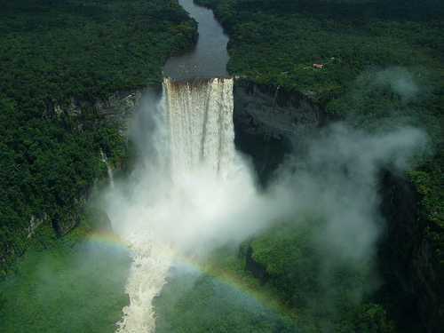
  • Son Doong Cave is the home of the large Rao Thuong River, that flows quite quickly underground, notably making rushing and roaring sounds audible outside the cave.
  • The entrance to Son Doong Cave was rediscovered in 2008, again by Ho Khanh, and it wasn’t until 2009 that it was first explored, with Ho Khanh’s assistance and a team of cave experts and scientists, as steep inclines and intimidating sounds caused by the hidden river, would’ve deterred locals.
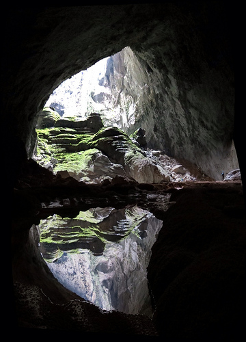
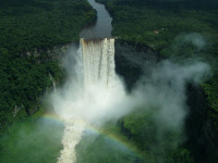
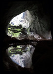
Son Doong Cave, Trivia, Ten Random Facts, Cave, Water, Vietnam, Entry, Exit, Light, Reflection
Son Doong Cave
Image courtesy of Doug Knuth/Flickr
  • As of 2015, Son Doong Cave was still listed as the largest known cave on Earth, at 200 metres (660 feet) in height, 5 kilometres (3.1 miles) in length and 150 metres (490 feet) in width, at the greatest points.
  • Limestone is the main stone type that makes up Son Doong Cave and it also has some large deposits of calcite.
  • Particularly large cave pearls and stalagmites can be found in Son Doong Cave, with the cave pearls reaching sizes of around 7.5 cm (3 inches) in diameter and stalagmites reaching up to 80 metres (262 feet) in height.
  • The first tourists to explore Son Doong Cave did so in late 2013, spending $3,000 USD per person, while only 500 permits to enter the cave were given out in 2015.
  • Son Doong Cave is located in a section of the Phong Nha-Kẻ Bàng National Park, which was declared a UNESCO World Heritage Site in 2003.
Bibliography:
Lee J, Dive Into ‘Infinity’ With Dizzying Views of A Colossal Cave, 2015, National Geographic, http://news.nationalgeographic.com/2015/05/150520-infinity-cave-son-doong-vietnam-virtual-tour-photography-conservation/
Son Doong Cave, 2015, Oxalis Travel, http://oxalis.com.vn/cave/son-doong-cave/
Sơn Đoòng Cave, 2015, Wikipedia, https://en.wikipedia.org/wiki/S%C6%A1n_%C4%90o%C3%B2ng_Cave

Amazon:       

Cape of Good Hope

Cape of Good Hope

You better have a lot of hope when travelling the seas of the Cape of Good Hope.

  • The Cape of Good Hope is a narrow, rocky piece of land that juts out into the South Atlantic Ocean, found in South Africa’s Cape Peninsula.
  • The Cape of Good Hope is part of the Table Mountain National Park, and contrary to popular belief, is not actually the southernmost point of Africa, as that title goes to Cape Agulhas.
  • ‘The Cape of Good Hope’ is also known simply as ‘The Cape’ and is known in Afrikaans as ‘Kaap die Goeie Hoop’.
  • The Cape of Good Hope is regarded as particularly important by many sailors, as it is used as a reference point when sailing to Australia or East Asia.
  • Bartolomeu Dias, an explorer from Portugal, was the first known person from Europe to discover the Cape of Good Hope, doing so in 1488, and named it ‘Cape of Storms’.
Cape of Good Hope, Water, Africa, Rocks, Trivia, Ten Random Facts, Place, Head
Cape of Good Hope
Image courtesy of Iryna Kuchma/Flickr
  • The Da Gama and the Dias Crosses are situated on the Cape of Good Hope as beacons, and when the two are aligned they point towards a major water vehicle hazard known as ‘Whittle Rock’.
  • Despite the bad weather that Bartolomeu Dias experienced at the Cape of Good Hope, John II of Portugal, the king who commissioned the initial expedition, renamed it as such to portray a more positive perspective on sailing to India.
  • There are around 250 bird species, including penguins, that are found in the Cape of Good Hope vicinity, while other animals from zebras, deer, reptiles, antelopes, otters and rodents are also found in the area.
  • Approximately 1100 native plant species populate the Cape of Good Hope, and includes large quantities of shrubby vegetation known as ‘fynbos’, like proteas, cone bushes and tree pincushions.
  • By legend, the Cape of Good Hope is the haunted location of the ghostly ship The Flying Dutchman, which is said to be cursed so that it can never reach land.
Bibliography:
Cape of Good Hope, 2015, Pano, http://www.airpano.com/360Degree-VirtualTour.php?3D=cape-good-hope-rsa
Cape of Good Hope, 2015, Wikipedia, https://en.wikipedia.org/wiki/Cape_of_Good_Hope

Amazon:       

Loch Ness

Loch Ness

Loch Ness is a placed of busted myths and mythical monsters.

  • Loch Ness is a freshwater lake, or loch as it is known in Scotland, found in the Highlands of Scotland, in the United Kingdom in Europe.
  • Loch Ness is the largest lake in Scotland by volume, at 7.5 cubic kilometres (1.8 cubic miles), and it reaches a depth of 230 metres (755 feet) and covers an area of 57 square kilometres (22 square miles).
  • The popularity of Loch Ness is caused primarily by the potential monster, named after the lake, that is believed by some to dwell there, and information about the creature was publicised in 1933.
  • Species of eels, salmon, trout, minnows and sea sturgeons, among other aquatic animals, are native to the waters of Loch Ness.
  • An artificial island in the southern area of Loch Ness was created before the 1400s AD, and while it has been called various names, it is known as Cherry Island today.
Loch Ness, water, lake, Scotland, Trivia, Blue, Ten Random Facts, Place, Europe
Part of Loch Ness
Image courtesy of Dave Conner/Flickr
  • The ruins of Urquhart Castle can be found on the banks of the western side of Loch Ness, and was built from the 1200s.
  • Loch Ness is used in two hydroelectricity plants, the Glendoe Hydro Scheme and the Foyers pumped-storage scheme.
  • Tourists visiting Loch Ness can choose from a variety of cruises that travel across the lake, while hiking along tracks in the nearby woodlands, sailing, and fishing are also popular activities.
  • In July 1966, Brenda Sherratt crossed the full length of Loch Ness by swimming, and was the first to do so, accomplishing the feat at age 18.
  • River Moriston, River Oich, River Enrick, River Foyers, and River Coilte each feed into Loch Ness, while the Ness River flows out of the lake.
Bibliography:
Loch Ness, 2015, Visit Scotland, http://www.visitscotland.com/en-au/info/towns-villages/loch-ness-p868181
Loch Ness, 2015, Wikipedia, https://en.wikipedia.org/wiki/Loch_Ness

Amazon:        

Table Mountain

Table Mountain

Table Mountain is a masterpiece of the giants.

  • Table Mountain is a mountainous landform with a particularly flat top, found near South Africa’s Cape Town.
  • From sea level, Table Mountain is 1084.6 metres (3,558 feet) in height, and at the top it is 3 kilometres (2 miles) across at its widest point.
  • The first record of a person climbing Table Mountain was in 1503, and the climber was António de Saldanha, a navigator from Portugal and modern day Spain.
  • Table Mountain is notably topped with orographic clouds regularly, that create a surreal table cloth like covering over the mountain; a local legend attributes this to a smoking duel between the Devil and a pirate.
  • At least 1500 species of plant populate Table Mountain, most of which are endemic to the area and referred to as ‘fynbos’, or shrubby vegetation, some of which is endangered.
Table Mountain, Trivia, Ten Random Facts, South Africa, Capetown, Rocks, City, Nature
Table Mountain
Image courtesy of warrenski/Flickr
  • Animals found on Table Mountain include rock hyraxes, snakes, amphibians, mongooses, lizards and porcupines, as well as the mountain’s rare ‘ghost frogs’ that are critically endangered.
  • There are two main ways Table Mountain can be accessed, by hiking and by a cableway; the latter built from 1926 to 1929 after years of ideas and planning.
  • Sandstone makes up most of the rock structure of Table Mountain, and it also features unusual sandstone cave complexes.
  • Table Mountain is very popular among tourists, and as of 2015, at least 24 million people had used the cableway since it was built.
  • Table Mountain was voted as one of the New 7 Wonders of Nature in 2011, and it is part of the Table Mountain National Park.
Bibliography:
Table Mountain, 2014, SA Venues, http://www.sa-venues.com/attractionswc/table-mountain.htm
Table Mountain, 2015, Wikipedia, https://en.wikipedia.org/wiki/Table_Mountain

Amazon:       

Kaieteur Falls

Kaieteur Falls

Kaieteur Falls is beautiful isolated in the rainforests of South America.

  • Kaieteur Falls is a waterfall located in the Essequibo area in Guyana, located in northern South America, and it is part of the Kaieteur National Park.
  • Kaieteur Falls has a drop of 226 metres (741 feet) in height, and a width up to 113 metres (370 feet).
  • In early 1870, geologist and explorer Charles Brown of Britain, was the first European to see Kaieteur Falls, and he discovered the feature while surveying the area.
  • Kaieteur Falls is not easily accessible, as it is located in a remote part of the Guyana rainforest, and as such, visitors are required to travel in a plane to the nearby airstrip and walk into the area.
  • The name ‘Kaieteur Falls’ comes from term ‘Kaieteur ‘ meaning ‘old-man’ in the local tribal language, which is said to have originated from the legend of an old man venturing over the falls in a purposeful or forced manner.
Kaieteur Falls, Place, Trivia, Random Facts, Water, Waterfall,
Kaieteur Falls
Image courtesy of Soren Riise/Flickr
  • The cliff of Kaieteur Falls is said to be made of conglomerate rock and sandstone, and it is part of the Guiana Highlands, which is part of the Guiana Shield.
  • Kaieteur Falls is fed by Potaro River, which eventually runs into the Essequibo River, that flows into the Atlantic Ocean.
  • The water of Kaieteur Falls is a muddy or coffee brown colour, and the water flows into the large gorge situated below.
  • Due to the inaccessible nature of Kaieteur Falls, it has remained an unspoilt environment, and while efforts have been made to have the site listed as a UNESCO World Heritage site, as of 2015, it had been unsuccessful.
  • Roughly 651 cubic metres (23,000 cubic feet) of water rush over the edge of Kaieteur Falls each second, and the sheer volume of water, combined with the waterfall’s height and width, makes it one of the largest falls on earth.
Bibliography:
Kaieteur Falls, 2015, BeautifulWorld, http://www.beautifulworld.com/south-america/guyana/kaieteur-falls
Kaieteur Falls, 2015, Wikipedia, https://en.wikipedia.org/wiki/Kaieteur_Falls
Kaieteur Falls, n.d, World of Waterfalls, http://www.world-of-waterfalls.com/latin-america-kaieteur-falls.html


Amazon:        

Curonian Spit

Curonian Spit

Enjoy some fish on a spit at the Curonian Spit.

  • The Curonian Spit is a long, thin piece of land, known as a ‘spit’, that separates two water bodies – the Baltic Sea and the Curonian Lagoon, in Lithuania in northern Europe, and western Russia.
  • The UNESCO World Heritage Convention designated the Curonian Spit, also known as ‘Kuršių nerija’ a World Heritage Site in the year 2000, and the area contains a number of reserves and national parks.
  • As a sand dune formation, the creation of the Curonian Spit possibly occurred through wind and water movements that piled sand at levels high enough to deter water.
  • The Curonian Spit spreads a length of 98 kilometres (61 miles) with a width ranging from 0.4 to 3.8 kilometres (0.25 to 2.4 miles), and some of the sand dunes can reach heights of up to 60 metres (197 feet).
  • Curonians, Russians, Lithuanians, Germans and Prussians have all occupied the Curonian Spit at various stages, and according to a native Balt legend, the spit was created by a child Neringa, a giantess, who enjoyed the shore as a play site.
Curonian Spit, Sand, Water, Trivia, Ten Random Facts,  Beach, Russia, Place
Curonian Spit
Image courtesy of Borya/Flickr
  • Around the mid 1700s, after significant deforestation caused a lack of sand dune stabilisation, 14 villages on the Curonian Spit were buried by sand.
  • Successful large scale revegetation of the Curonian Spit sand dunes has occurred over two centuries, and a sand ridge was also created during this time to impede sand movement.
  • Despite the prominence of sand dunes in the Curonian Spit vicinity, areas of the spit are rich in flora and fauna, while approximately 10 to 20 million birds migrate across the area annually.
  • A stone sundial has been constructed on the top of Parnidis dune, one of the Curonian Spit’s many dunes, located in the town of Nida.
  • The Curonian Spit is popular among tourists for bird watching, boating and fishing, although a permit to catch fish is required, and there are a number of historic villages and museums to visit in the area.
Bibliography:
Curonian Spit, 2015, UNESCO World Heritage Convention, http://whc.unesco.org/en/list/994
Curonian Spit, 2015, Wikipedia, https://en.wikipedia.org/wiki/Curonian_Spit
Human Impact, nd, Kuršių nerijos, http://www.nerija.lt/en/culture/human-impact

Amazon:       

Related Posts Plugin for WordPress, Blogger...