Sundarbans

Sundarbans

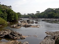
Large forests like Sundarbans are perfect places to hide.

  • Sundarbans, in Asia, is the world’s biggest connected mangrove forest, and 40% of the forest is in India, while the other 60% can be found in Bangladesh.
  • The area of Sundarbans sits in the Bay of Bengal and covers 10,000 square kilometres (3900 square kilometres).
  • Four parts of Sundarbans are individually protected, as a National Park in India, and as a South, East and West Wildlife Sanctuary in Bangladesh, and the area as a whole, has been reserved since 1878.
  • When translated from the Bengali term ‘Shundorbôn’, ‘Sundarbans’ has the meaning ‘beautiful forest’.
  • Civilisations have lived among the Sundarbans since the third century, and the area was also a common hideout for criminals.
Sundarbans
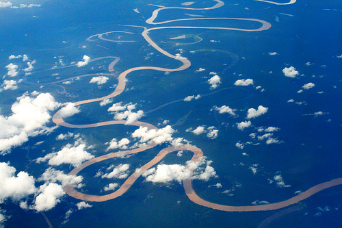
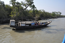
Part of the Sundarbans
Image courtesy of Marufish/Flickr
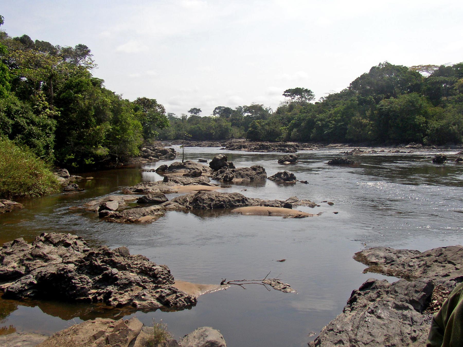
  • Sundarbans is the home to hundreds of waterways that connect to nearly every part of the forest, allowing the vast majority of areas to be accessible by water transport.
  • The UNESCO World Heritage Convention declared part of the Sundarbans as a World Heritage Site in 1997, and the area contains numerous threatened or endangered species.
  • Sundarbans is the home to almost 50 species of mammals, including the Royal Bengal Tiger, nearly 60 reptile species, over 300 species of birds and more than 300 plant species.
  • Up to 50 people suffer fatalities from tiger attacks in Sundarbans annually, although there has been active measures to reduce this number, including releasing livestock into the area, to provide an alternative meal for the tigers.
  • In late 2014, an oil-liner sunk in the Sundarbans area, spilling 358,000 litres (95,000 gallons) of oil, and the spill further threatened already threatened species in the area.
Bibliography:
The Sundarbans, 2015, UNESCO World Heritage Convention, http://whc.unesco.org/en/list/798
Sundarbans, 2015, Wikipedia, http://en.wikipedia.org/wiki/Sundarbans

Amazon:    

Amazon Basin

Amazon Basin

Take in the beauty of the Amazon Basin.

  • The tropical Amazon Basin includes the Amazon River and surrounding areas, in South America, and it drains large volumes of water into the Atlantic Ocean.
  • Approximately two fifths of South America is covered by the Amazon Basin, which equals an area of around 6.9 million square kilometres (2.67 million square miles).
  • The Amazon Basin is the largest of its type on earth, and includes the world’s greatest rainforest, the Amazon rainforest, which covers a majority of the basin.
  • The Amazon Basin contains numerous rivers and tributaries, numbering into the thousands, and the collective flow of water from these sources, into the ocean, is approximately a sixth of the world’s total.
  • The Amazon Basin is said to be the home to over 1500 species of birds, 14,000 mammal species, 2,200 species of fish, 1000 amphibian species, many reptiles, and thousands of insect species.
Amazon Basin, Amazon River, Brown, Long, Windy, Aerial, Lush, Clouds, Ten Random Facts, South America, Rainforest
Part of the Amazon Basin
Image courtesy of Olga Stavrakis/Flickr
  • The Amazon Basin area houses millions of people, including significant populations of indigenous Americans, with the majority settled around the rivers.
  • Typically, the Amazon Basin has a wet and hot atmosphere; floods are common; and while cold temperatures are not, they do suddenly occur and can be damaging to the flora and fauna.
  • Parts of the Amazon Basin have been cleared for agricultural or mining purposes, notably for soybeans, cattle and gold; and the deforestation has caused extinction of many species.
  • Portuguese and Spanish are the most spoken languages of the Amazon Basin area, while hundreds of indigenous and nearly lost languages are evident.
  • The peak, Yerupajá, in Peru’s Waywash mountain range, is the Amazon Basin’s tallest watershed point, reaching 6,635 metres (21,768 feet) in height.
Bibliography:
Amazon Basin, 2015, Wikipedia, http://en.wikipedia.org/wiki/Amazon_basin
Amazon Basin – Brazil, 2015, World Wildlife Fund, http://www.worldwildlife.org/ecoregions/nt0168
Amazon Basin Facts, n.d, Meet Our Animals, http://nationalzoo.si.edu/animals/amazonia/facts/basinfacts.cfm

Amazon:     

Okapi Wildlife Reserve

Okapi Wildlife Reserve

Watch the spectacular wildlife at Okapi Wildlife Reserve.

  • Okapi Wildlife Reserve is a protected area in Africa’s Democratic Republic of Congo, in the Ituri Rainforest.
  • ‘Okapi Wildlife Reserve’ is named after its primary protected animal, the okapi, with roughly 5000 located in the park, a sixth of the estimated total population.
  • Okapi Wildlife Reserve covers an area of 13,726 square kilometres (5,300 square miles).
  • Over 100 species of mammal are found in the Okapi Wildlife Reserve, including, but not limited to, leopards, antelope, elephants, crocodiles, okapis, primates, buffalo; as well as more than 370 bird species.
  • The UNESCO World Heritage Convention declared Okapi Wildlife Reserve a World Heritage Site in 1996.
Okapi National Park, River, Reserve, Rocks, Water, Land, Environment, Place, Africa
 Part of Okapi Wildlife Reserve
Image courtesy of Wikimedia Commons
  • Okapi Wildlife Reserve is the home to three rivers, the Epulu, Ituri and Nepoko Rivers; Mbiya Mountain; as well as numerous deposits of various rocks and minerals including gneiss, mica and granite.
  • The Okapi Conservation Project supports and partners with the Okapi Wildlife Reserve, and helped to establish the reserve in 1992.
  • Okapi Wildlife Reserve is the home of the Epulu Conservation and Research Center, established in 1928, where the Okapi Conservation Project does its work; and the function of the centre is to manage the okapi breeding program, conservation and research, and occasionally send small quantities of okapi to zoos.
  • Approximately 80% of the Okapi Wildlife Reserve can be used for hunting by the thousands of native people living there, for the purpose of providing food to the local communities and villages, as long as traditional techniques are used; but despite this, poaching, deforestation, gold mining and political instability all continue to endanger the reserve.
  • The Epulu Conservation and Research Center and the Okapi Conservation Project in the Okapi Wildlife Reserve suffered a major setback in 2012, when it was directly attacked by a group of rebels and poachers, which resulted in blazed buildings, a number of human fatalities, and death of all fourteen okapi in the breeding program.
Bibliography:
Okapi Wildlife Reserve, 2014, Wikipedia, http://en.wikipedia.org/wiki/Okapi_Wildlife_Reserve
Okapi Wildlife Reserve, 2015, UNESCO World Heritage Convention, http://whc.unesco.org/en/list/718
Okapi Faunal Reserve, Democratic Republic of Congo, n.d, The Encyclopaedia of Earth, http://www.eoearth.org/view/article/155015/

Amazon:     

Everglades National Park

Everglades National Park

Everglades National Park is a sight to see and a place to protect.

  • Everglades National Park is tropical national park located in the United State’s Florida, and it contains significant flora and fauna, as well as numerous archaeological sites.
  • The area of Everglades National Park spreads over approximately 1.5 million acres (607,000 hectares).
  • Everglades National Park is a UNESCO World Heritage Site, declared in 1979, and it has been listed as a ‘Wetland of International Importance’, as well as an ‘International Biosphere Reserve’.
  • The primary rock base of Everglades National Park is limestone, which collects and gathers rainwater, and is important due to the park’s lack of underground water sources.
  • Everglades National Park became a national park on 6 December, 1947, for the uncommon reason of preserving the ecosystem, that includes marine, slough, pine forest, mangrove and coastal habitats.
Everglades National Park, Trees, Grass, America, Dawn, Morning, Misty, Landscape, Forest
Part of Everglades National Park
Image courtesy of Miguel Vieira/Flickr
  • Everglades National Park supports numerous species including at least 40 mammal species, reptile species numbering up to 50, 400 bird species, and up to 300 species of fish; and many of the species are endangered; while notable species include the American crocodile, Florida panther and West Indian manatee.
  • During Native American history, Everglades National Park was used by two tribes as a border, and the first Europeans to set foot in the area were Spanish, in the 1500s.
  • Everglades National Park was significantly damaged by the building of canals in above ground water bodies, primarily around the 1900s; and in 1989, the US President George Bush committed the government to reversing the damage.
  • December marks the beginning of the peak tourist season at Everglades National Park, and hiking, canoeing and camping are common activities; and the park sees over a million tourists every year.
  • During its history, Everglades National Park has been endangered due to damaging hurricanes and nearby urban expansion, and it has also been negatively affected by droughts, fires, decreasing water quantities, rising sea levels, mercury poisoning and introduced species.
Bibliography:
Everglades National Park, 2015, National Park Foundation, http://www.nationalparks.org/explore-parks/everglades-national-park
 Everglades National Park, 2015, UNESCO World Heritage Convention, http://whc.unesco.org/en/list/76
Everglades National Park, 2014, Wikipedia, http://en.wikipedia.org/wiki/Everglades_National_Park


Amazon:     

Mount Etna

Mount Etna

Mount Etna is explosive tonight!

  • Mount Etna is a volcanic mountain found near Sicily’s coast, in Italy, Europe, that actively erupts in a stratovolcanic way.
  • Mount Etna reaches approximately 3,330 metres (10,925 feet) in height, taking the position of being Europe’s most elevated active volcano.
  • Mount Etna became a national park area in 1987, and in mid 2013, the main part of the volcano was declared a UNESCO World Heritage Site.
  • Mount Etna spreads 1,190 square kilometres (459 square miles) in area, and is 140 kilometres (87 miles) in circumference.
  • ‘Mount Etna’ is also known as ‘Mongibello’ or ‘Montebello’ and ‘Mungibeddu’ in Italian and Sicilian respectively, as well as ‘Muntagna’.
Mount Etna, Volcano, Stratovolcanic, Scenic, Italy, Sicily,  White, Sky, Flickr
Mount Etna
Image courtesy of Dennis Jarvis/Flickr
  • In 2008, Mount Etna had five primary craters and at least 300 side vents that have been used in the past to eject eruptions; while parts of the mountain have collapsed on a number of occasions.
  • The name ‘Mount Etna’ probably originates from either ‘attuna’ or ‘aithō’, meaning ‘furnace’ in Phoenician or ‘I burn’ in Greek respectively, and the volcano features prominently in Greek mythology and literature.
  • Records of Mount Etna eruptions date back thousands of years, and there have been numerous significant eruptions, including many in the last hundred years.
  • Mount Etna is the one of the most popular tourist areas in Sicily, and it can be either hiked or driven up using suitable vehicles, and it is also a leading site of volcanic research.
  • Mount Etna is surrounded by numerous communities, that, in the event of an eruption, are generally protected from lava flow using diversion tactics that include deposits, explosives and holes.
Bibliography:
Mount Etna, 2014, Wikipedia, http://en.wikipedia.org/wiki/Mount_Etna
Mount Etna, 2015, BBC, http://www.bbc.co.uk/science/earth/collections/mount_etna
Mount Etna, 2015, UNESCO World Heritage Convention, http://whc.unesco.org/en/list/1427

Amazon:     

Ruby Falls

Ruby Falls

Ruby Falls is the perfect name for a breathtaking waterfall.

  • Ruby Falls is a waterfall found in the subterranean area of Tennessee’s Lookout Mountain, in Chattanooga, in the United States.
  • Ruby Falls is found in a cave carved into limestone rock, and the cave has been formed by water erosion.
  • Ruby Falls was first discovered in 1928, when access to the area was drilled into accidentally by the chemist Leo Lambert, who had a fascination with caves and was trying to create a new path into the nearby Lookout Mountain Cave.
  • Ruby Falls is formed by an underground stream that is 341 metres (1120 feet) below ground; and the falls are accessed by an elevator.
  • In 1930, Ruby Falls cave was opened for tourism, and the caves were among the first to feature electric lights for tourism purposes.
Ruby Falls, Cave, Underground, Red, Beauty, Ten Random Facts, Europe,
Ruby Falls
Image courtesy of Chris Faulkner/Flickr
  • New paths have been created in the Ruby Falls area, such as in 1954 to avoid the consumption of water that has concentrated levels of magnesium in it, and later in 1975, to provide an alternate exit in case the main elevator ever malfunctions.
  • ‘Ruby Falls’ was named after the wife of Leo Lambert, who was called ‘Ruby’.
  • Ruby Falls is 44 metres (145 feet) tall, making it the largest underground waterfall open to visitors in America, while the cave is the deepest with public access in the United States, and it is considered as one of the most amazing waterfalls in the world.
  • Ruby Falls is a popular tourist destination, and it has been mentioned multiple times throughout literature, particularly in song lyrics.
  • Ruby Falls requires an entrance fee to access the falls, and groups are guided by a designated staff member.
Bibliography:
Ruby Falls, 2014, Wikipedia, http://en.wikipedia.org/wiki/Ruby_Falls
Ruby Falls History, 2014, Ruby Falls, http://www.rubyfalls.com/things-to-do/cave-tours/ruby-falls-history/

Amazon:     

Related Posts Plugin for WordPress, Blogger...