


A giant’s table: Mount Roraima.
- ‘Mount Roraima’ is also known as ‘Monte Roraima’ in Portuguese, and the mountain is also called ‘Tepuy Roraima’ and ‘Cerro Roraima’.
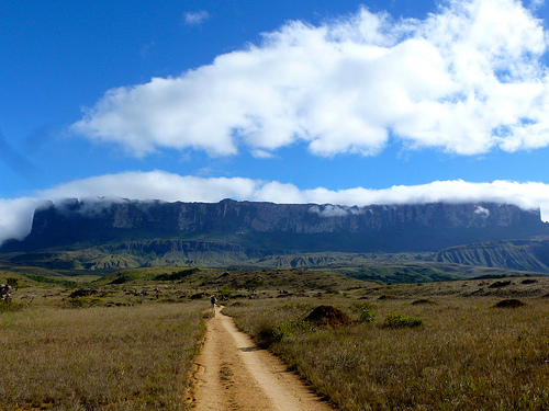
- Mount Roraima is a table-top plateau located mostly in Venezuela, South America, but it also occupies some of Brazil and Guyana.
- Mount Roraima is the highest landform in Guyana, although not the other states.
- Mount Roraima reaches 2,810 metres (9,219 feet) in height at its peak, with wall like cliffs reaching 400 metres (1,300 feet) in height.
- Mount Roraima was first documented by the “Old World” (Europe, Africa and Asia) in 1596 by Sir Walter Raleigh who was an explorer from England.
Roraima
Image courtesy of Erik Cleves Kristensen/Flickr
- Mount Roraima is the home of significant wildlife and vegetation, including rare heather plants.
- The first expedition to climb Mount Roraima was led by the British Everard im Thurn, in 1884, who later become the Governor of Fiji.
- Mount Roraima is typically reached by hikers via Venezuela, as the Brazilian natives can be hostile, and it would require climbing the large cliffs in Guyana or Brazil.
- Mount Roraima generally takes a couple of days to reach and a day to climb, and is a popular spot for a camp-out.
- Mount Roraima is approximately 14 kilometres (9 miles) in length and has a sandstone surface.
