Hitachi Seaside Park is a park of wonder.
- Hitachi Seaside Park is a park located on the coast of Japan’s largest island, Honshu, in the city of Hitachinaka, in the Ibaraki Prefecture.
- ‘Hitachi Seaside Park’ is known as ‘Kokuei Hitachi Kaihinkōen’ in Japanese.
- Hitachi Seaside Park comprises of approximately 190 hectares (470 acres) of area, that includes a hill, forests, garden, entertainment area and other features.
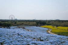
- Hitachi Seaside Park notably contains 4.5 million blue nemophila plants, 1 million daffodils and 170 different varieties of tulip, as well as many other flowering plants and vegetation.
- Hitachi Seaside Park features a Ferris wheel that is a good way to gain great views of the park, as well as a rollercoaster, golf area, a labyrinth, a water playground and more.
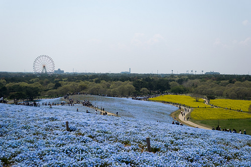
Hitachi Seaside Park
Image courtesy of Temaki/Flickr
- Hitachi Seaside Park is the venue for the Rock in Japan Festival, the largest rock genre music festival in Japan, that is held each year in August.
- Hitachi Seaside Park has entrance and parking fees, and pets on leashes are welcome, although they are restricted in some areas.
- Hitachi Seaside Park contains numerous cycling tracks, public paths and recreation areas.
- Although flowering occurs all year, the majority of flowers in Hitachi Seaside Park bloom in spring, notably the nemophilas, which led to the name ‘Nemophila Harmony’ for this period.
- Since the Fukishima nuclear disaster of 2011, some areas of Hitachi Seaside Park have been closed at various times due to rising radiation levels, however, the levels are closely monitored and decontamination has occurred when necessary.
Bibliography:
Flower Paradise at Hitachi Seaside Park, Japan, 2012, Amusing Planet, http://www.amusingplanet.com/2012/06/flower-paradise-at-hitachi-seaside-park.html
Hitachi Seaside Park, 2013, Visit Ibaraki Japan, http://visitibaraki.net/hitachi-seaside-park-post.html
Hitachi Seaside Park, 2014, Wikipedia, http://en.wikipedia.org/wiki/Hitachi_Seaside_Park
Menu, 2014, Hitachi Seaside Park, http://hitachikaihin.go.jp/